3D Interaction Testbed
One problem with the research work on 3D interaction is that there are no clearly defined evaluation methods, stimuli as well as representative tasks akin to those found in other disciplines of science. Most often, researchers trying to propose a new 3D interaction technique have to spend considerable time not only on its development, but also on authoring new content and tasks for the technique's evaluation. This page is intended to list 3D environments that can be easly employed in testing different interaction techniques. The environments are accompanied by the tasks that can be reused by evaluators.
- AlphaVille - Example of 3D Outdoor Environment
- ToDo - Example of 3D Indoor Environment
- ToDo - Example of 3D Information Visualisation Environment
AlphaVille - Example of 3D Outdoor Environment
AlphaVille is a small (about 10km2) virtual 3D city created to represent the most common real-world street layouts (see Figure 1 below). The model of the city is very simple - it consists of five parts: Center, East, West, North and South for the streets network and a number of blocks and houses (see images below). All of these low-poly models are availbe in OBJ, FBX and MAX file formats and are availbe for free as part of the 3D City Building Blocks project that aims to provide an easy to use set of resources for the creation of simple 3D city environments. The center part of the city is used on this site in our WebGL+three.js online testbed implementation; AlphaVille was also used in the Unity3D project created for the evaluation of street-level navigation.


Street-level navigation tasks
This section describes the tasks representing various conditions a user is likely to experience using a 3D map application while being in the street level. The tasks are based on the work of Bowman D. A., Koller D., and Hodges L. F.: A methodology for the evaluation of travel techniques for immersive virtual environments. VR, 3(2). 1998.
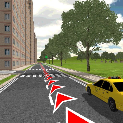
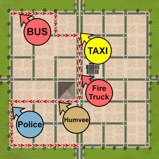
Specifically for these tasks the layout of the streets was represented as a graph in the OpenStreetMap (OSM) format. Twelve paths of similar complexity, 4x1.5km for the training and 8x2.5km for the main part of the evaluation, are defined. For each route, five cars: a red bus, a red firetruck, a brown humvee, a black-and-white police car, and a yellow taxi were parked on the way in a random order.
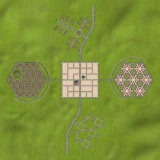
1) Layout of the city
2) Travel task
3) Look-around task
4) Cognitive task
Tasks include:
- Travel Task (Camera Movement) - For this task, the participants are asked to simply follow a predefined path marked with red arrows projected on streets (see Figure 2 above). Once they arrived at the end of the path, they are asked to recall positions of the cars they have seen on the way (Figure 4).
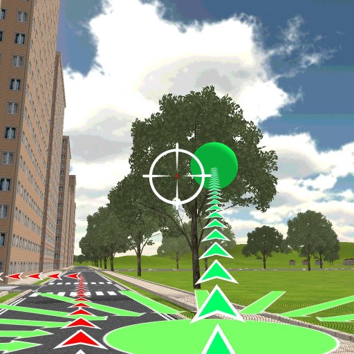
- Travel & Look-Around Task (Camera Movement and Orientation - This task is similar to the first task. Additionally, the participants are asked to shoot green balloons that are deployed on the way (15 balloons for each route). The positions of the balloons are clearly marked in the environment (see Figure 3). To shoot a balloon the user has to orient the camera directly towards the target and wait for one second.
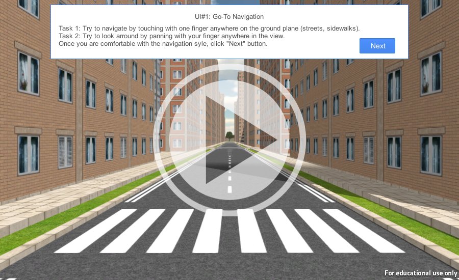
The demo displayed below presents an application used in the evaluation of street-level navigation techniques in 3D digital cities on mobile touch devices. Step 3 of the evaluation presents the Travel & Look-Around task described above. Note that the system is not fully functional as it was intended for touch devices.